Run: Salt Creek      
Section:        
         
Class: III/IV (V)   Put-In: Salt Creek Rd. (see text)    
Gradient: 120,0,0   Take-Out: Henderson Lake Rd.    
Length: 3          
Shuttle: Salt Creek/ CR96/ Hopeful/ Henderson Lake/   Delorme Gazeteer: P32 E4/5    
Water Q: Primary Gage: none    
Links: TOPO MAP Required Level: visual     
  PICTURES Indicator Gage: Hatchet below Rockford    
  TRIP REPORT Required Level: Rising*    
Notes: GOOGLE MAP          
Put in on Salt Creek road or upstream if needed (the best put-in is on private land at Salt Creek Rd., the other side of the bridge would be a tough put-in). This run requires a lot of water and a good rain. This is a nice little creek run near the highest point in the state. It is totally different from the runs on Lookout or Sand Mountain. The bedrock is some hard granitic rock. The creek above the Salt Creek crossing is small and sandy. There are few rapids above a class I riffle. Below the bridge the character changes. The creek becomes a boulder field with small ledges, holes, and drops. Then after a short stretch of good drops it drops over Salt Creek Falls. The drop is runnable I understand. However on the only descent I've made we portaged using ropes to lower the boats. The waterfall drops into a large amphitheater and is quite impressive. I understand the first person to run the drop was injured. After the waterfall the creek continues with class III quality drops for awhile and flattens out. Talladega County. by Will Reeves

The drops just above and below the big falls border on class IV at good water levels, especially if you have not seen them before. Sadly they don't last long. Portage Salt Creek Falls on the left where a trail will lead you to a place to lower your boats. The Falls are about 45' feet high with a deep pool but terraced 'steps'. We walked it since injuries were a likely option. We parked on river left at the bridge above the falls and got a nasty-gram from the landowner, even though all the posted signs are on the other side of the creek. If you can find a higher put-in, it may be a better option.
* The indicator runs bracket the watershed to the north and south. They have much larger watersheds so you probably want to catch Salt while they are rising. We ran Salt the day after a 2" rain when the Choccolocco was 2000 cfs. - Mark D'

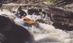
Richard Vest, Matt, and Rich did the 1st decent of Salt Creek Falls. Richard broke some ribs and Rich chipped a tooth I think. Matt ran it clean. I walked it. I think this was a 1st decent of Salt Creek but it didn't seem to be worthy of paddling again after that. This was done years ago. - Lenny Rubin

Finally, as of late 2010:

Maggie Johnston now owns the cabin on the hill across Talladega Creek from the Waldo Old Mill restaurant and rents it out as a guest house. This as an option for boaters who are interested in paddling Talladega Creek, Hatchet Creek or others in the area. See her
VRBO site