
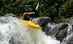
The main attraction here is Devils Den rapids, dubbed "The Alabama SixPack" by Mike Huff. They are just upstream of Lake Chinnabee on the west side of Mount Cheaha. It's a bit like the Tellico ledges, only compressed. Overall, they drop a total of almost 100' in a comparatively short distance. The first part is a 4' drop onto a 3' slide. The next is a like a big Powell Falls with a semi-launch pad on the left. After that is a slide or vertical slot move on the right, about 4' total. Next is the major move, a 12'-15' drop, only do-able at low water on far left with a ferry just above it from right to left, with consequences if you mess up. You can run a slot on the right at moderate to higher water. The fifth part is a 6' pourover with a slot move (double drop?). Next is a 3' broken ledge followed by 3.5' slot / broken ledge. Finally after 50' of flatwater, you encouter a long "speedway boulder garden class IV" slide. Staying right is good since the rocks on the left seem to be pin-friendly. At least 100 yds of class III+ (with an ugly tree hazard as of spring 2010) brings you to the lake.
There are a couple of put in and take out options, depending on the season. You can always put in just above Cheaha Falls by hiking down a gated road uphill from Lake Chinnabee. The falls may be runnable (Bill Patterson thinks so). It is a 40' total drop with a boulder or two greeting your landing. The next mile or so has only a couple small rapids. You can also hike up and just run the Pack by parking at the lake and following the hiking path on river right. The lake parking area is the obvious take-out (be sure to pay the $3 user fee to avoid the big fine), but it is closed during the winter. You could walk the 1.3 miles back uphill to the main road, but I would not recommend that at all. Your other take out option is to set shuttle by driving downhill to the next road, FR637. Stay on 637C and you'll end up at a low water bridge. There are a few rapids and about 4 portages because of trees from the lake to FR 637C. Another good way to tell if Cheaha is going once you are there is the flow over the 637C bridge. If the water is flowing a foot or more over the bridge then it is really cranking. If it is dry, you are out of luck.
It's hard to judge level from afar. The pictures show a visual guide rock on river left at the lake that David Crow and Adama Wood like to use. The Hillabatchee gauge also seems to do pretty well based on a limited number of runs.
Finally, as of late 2010:
Maggie Johnston now owns the cabin on the hill across Talladega Creek from the Waldo Old Mill restaurant and rents it out as a guest house. This as an option for boaters who are interested in paddling Talladega Creek, Hatchet Creek or others in the area. See her VRBO site