
* Go to Real Time on bottom left, back out to the Birmingham TV station listings, get it from there.
|
|
|||||
| Run: | Cahaba River | |||||
| Section: | Upper | |||||
| Class: | I/II | Put-In: | US 11 | |||
| Gradient: | ~12'/mile | Take-Out: | CR 10 (Roper Rd) | |||
| Length: | 7 | Precip Gage: | Real Time - B'ham* | Acmar Well Nr Moody | ||
| Shuttle: | US 11/ CR 10 | Delorme Gazeteer: | P. 31 C8/D8 | |||
| Water Q: | Primary Gage: | Put-In Bridge | ||||
| Links: | TOPO MAP | Required Level: | 0' | |||
| PICTURES | Indicator Gage: | Cahaba nr Mtn Brook | ||||
| TRIP REPORT | Required Level: | 800 | ||||
| Notes: | ||||||
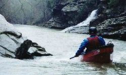
| This is the upper run on the Cahaba and therefore requires some
recent rain. There are indeed a lot of trees great and small across this stretch. We ran it at -2" and rising,
and it was adequate but low. We had to walk once and limbo several times, and at decent levels several more trees
would block the river. All the rapids are straightforard enough. Most of the gradient oocurs in two stretches before
and after the footbridge. The rapids towards the end have a few nice play waves that will get much better at good
levels. You will also encounter a high railroad trestle along the way. * Go to Real Time on bottom left, back out to the Birmingham TV station listings, get it from there. |
||||||